Districts, precincts, municipalities
Boundaries, registration, turnout, election results, comparison, and field-planning context.
Case study 01 · Statewide political intelligence
A statewide campaign research and strategy workspace that connects Rhode Island public records, elections, geography, voter rolls, candidate dossiers, money, government action, and agent-driven analysis.
The problem
A strategic question about a candidate can touch contribution filings, public statements, legislative votes, ethics matters, office history, municipal decisions, election results, district geography, registration, and turnout. Each source uses a different identifier, time period, record grain, and standard of proof.
The system preserves those differences while making them usable together. A matching name is a candidate link, not a person identity. A contribution is a financial event, not proof of influence. A complaint, finding, dismissal, and unresolved search gap remain different states. The agent inherits those rules from the tools instead of relying on a warning buried in prose.
Product thesis: the most valuable political AI is not the system that produces the strongest-sounding answer. It is the one that makes a complex answer fast to inspect, challenge, and revise.
The project workspace
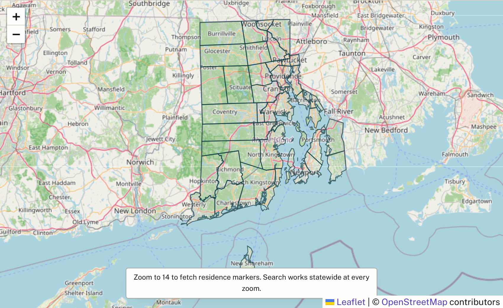
The map is a screenshot from the actual Rhode Island project, showing its coastline and municipal boundaries. The analyst example below uses a synthetic candidate to illustrate how an answer keeps evidence and interpretation separate.
Where does Candidate A's affordability message require closer review against contributions, ethics records, and recorded votes?
The evidence supports a review, not a verdict. Candidate A received reportable contributions connected to the development sector[1], publicly emphasized affordability[2], and cast recorded votes on measures with housing-cost consequences[3]. Those facts may create a message vulnerability, but they do not establish motive or improper influence. The ethics matter must be described by its official disposition rather than flattened into “a violation.” The analysis should test bill text, timing, stated rationale, counterexamples, and the complete contribution denominator before drawing a strategic conclusion.[4]
Source-issued account, transaction, date, amount, and filing locator.
Archived artifact, exact quote, speaker, publication date, and context.
Bill version, roll call, officeholder, date, and measure summary.
Complaint, finding, dismissal, warning, or open gap kept as distinct states.
INTERPRETATION LIMIT · Money, timing, message tension, or a graph path can justify a question. None alone proves influence, intent, misconduct, or causation.
System scope
The interface connects domains without pretending they are one universal table.
Boundaries, registration, turnout, election results, comparison, and field-planning context.
Temporal roles, races, public positions, official acts, coverage gaps, and candidate-link review.
Accounts, transactions, donors, payees, filings, contracts, procurement, payments, and outcomes.
Agendas, legislation, votes, recusals, implementation events, statements, and exact source locators.
Claims, official findings, denials, dismissals, corrections, and unresolved searches kept distinct.
Precinct intelligence, vote goals, issue salience, candidate comparisons, routing, and evidence-backed briefs.
Architecture
A federated evidence spine makes new products possible without erasing the identifiers, timing, or uncertainty of the original records.
Elections, filings, government records, geography, documents, and lawful voter-roll snapshots.
Immutable bytes, exact keys, temporal scope, manifests, typed locators, and coverage state.
Exact joins, reviewed correspondences, discovery candidates, and own-grain relations.
Dossiers, electorate comparison, money paths, timelines, gaps, evidence packets, and routing.
A visible workspace where retrieved evidence becomes a map, table, profile, timeline, or cited answer.
Ownership and outcome
Arthur originated the product vision and built the research program, data architecture, acquisition and validation workflows, geospatial surfaces, agent and tool contracts, campaign-analysis products, evaluation controls, and operating handoffs. Agent fleets accelerated research and implementation; Arthur set their scope, adjudicated their evidence, and owned the final system.
The system is being prepared for use by multiple candidates in upcoming Rhode Island state elections. That planned adoption is the outcome boundary today: it demonstrates a product moving from a personal research program toward real campaign use without claiming election results, persuasion effects, or field outcomes that have not happened.
A separate demonstration page runs the interaction model against a synthetic state with twelve fictional districts and seven prepared questions, each answer carrying its evidence, its counterevidence, and its interpretation limit. Its records are fictional and its answers are prepared; the project screenshot above shows actual Rhode Island geography.